Shipyard Locked
How long do I have?
- Joined
- Apr 25, 2017
- Messages
- 2,673
- Reaction score
- 5,723
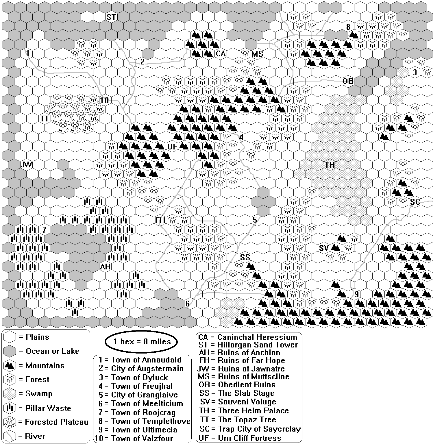
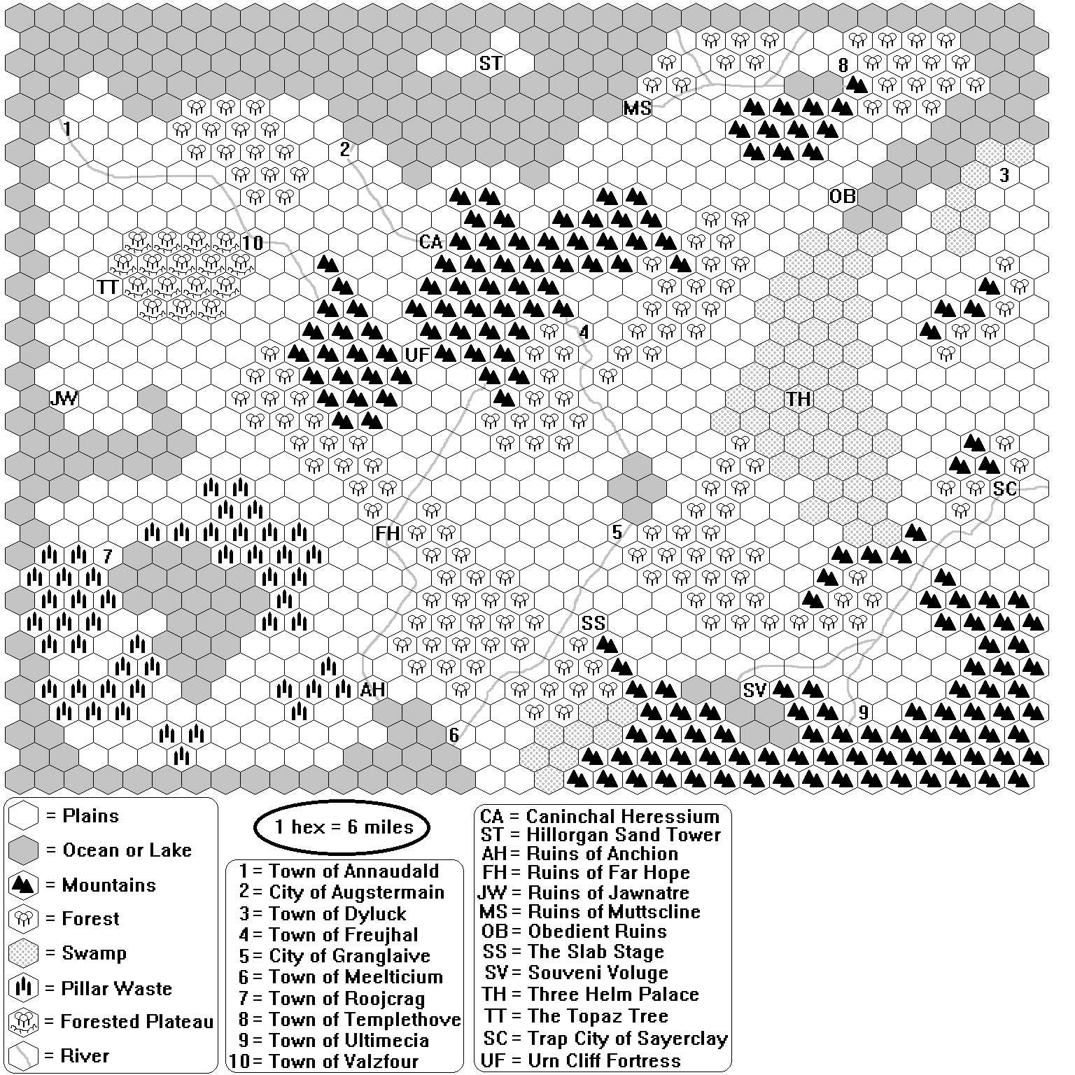
Who wants to mercilessly flay this D&D region hex map I'm working on?
Follow along with the video below to see how to install our site as a web app on your home screen.

Note: This feature currently requires accessing the site using the built-in Safari browser.

1. What font is that, looks like the original Macintosh.
2. Pillar Waste?
3. If you care about that sort of thing, this part...

...seems like a river violation.
TristramEvans said:could use a dash of colour ;)
The physical terrain does look sort of all over the place at a glance.

Water basics bug me here.
Where's the rain shadow in the center mts? Where are hills when you don't want to suggest high altitudes, snow packs, and rain shadows? Why are rivers reaching out to other rivers and splitting their streams (instead of meandering floodplains & oxbows)? River violations?...
I think a basic geography course is a fantastic investment on environmental features probability. Then, when you want exceptions, it gives you a more informed reference point to follow the ramifications.
Perhaps they extend into the earth as far down as they reach up above...
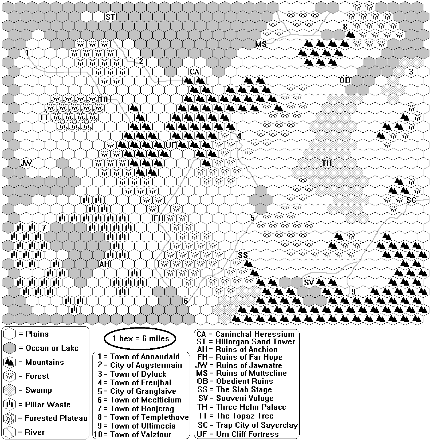
River MS. Muttscline to 8. Templethove Town still baffles. Maybe those are two lakes near 8. Templethove and the topographical drop off is so severe it creates a massive delta by MS. Muttscline?
OK. Less about the Ruins, more about the Cities and roads that interconnect them, please!
Heh, not quite hand-waving, for stuff that's downright odd you should have a reason (or at least pretend you doFor everything else, I default to CRKrueger's "Fantasy world bitch, I'm hand-wavin' away this sucka!"
). It's just ok to have some weirdness in the world itself, especially if in the history there has been cataclysms, godwars, etc.